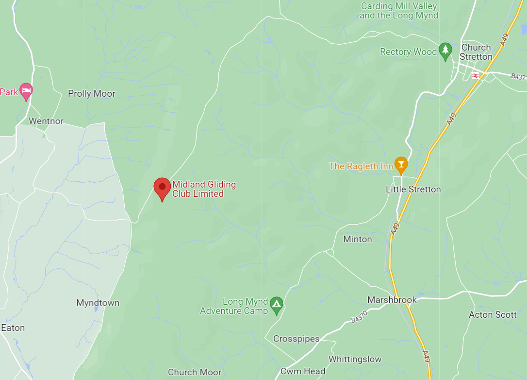
The Long Mynd is a range of hills just west of Church Stretton in the middle of Shropshire. The word Mynd in Welsh means “hill” so you can see we are not far from the Welsh border country or “Marches”.
The Mynd is 1500 feet high, so in the winter it can get snowed in and the roads to the club are steep and sometimes very difficult, if not impossible, to negotiate. They are not gritted in winter. However, there are always ways to get here, even if it means leaving a car at the bottom and having a short walk up the hill from Asterton.
We strongly advise calling the club first if there is any concern about the weather to check the road conditions.
Location
Post Code: SY6 6TA
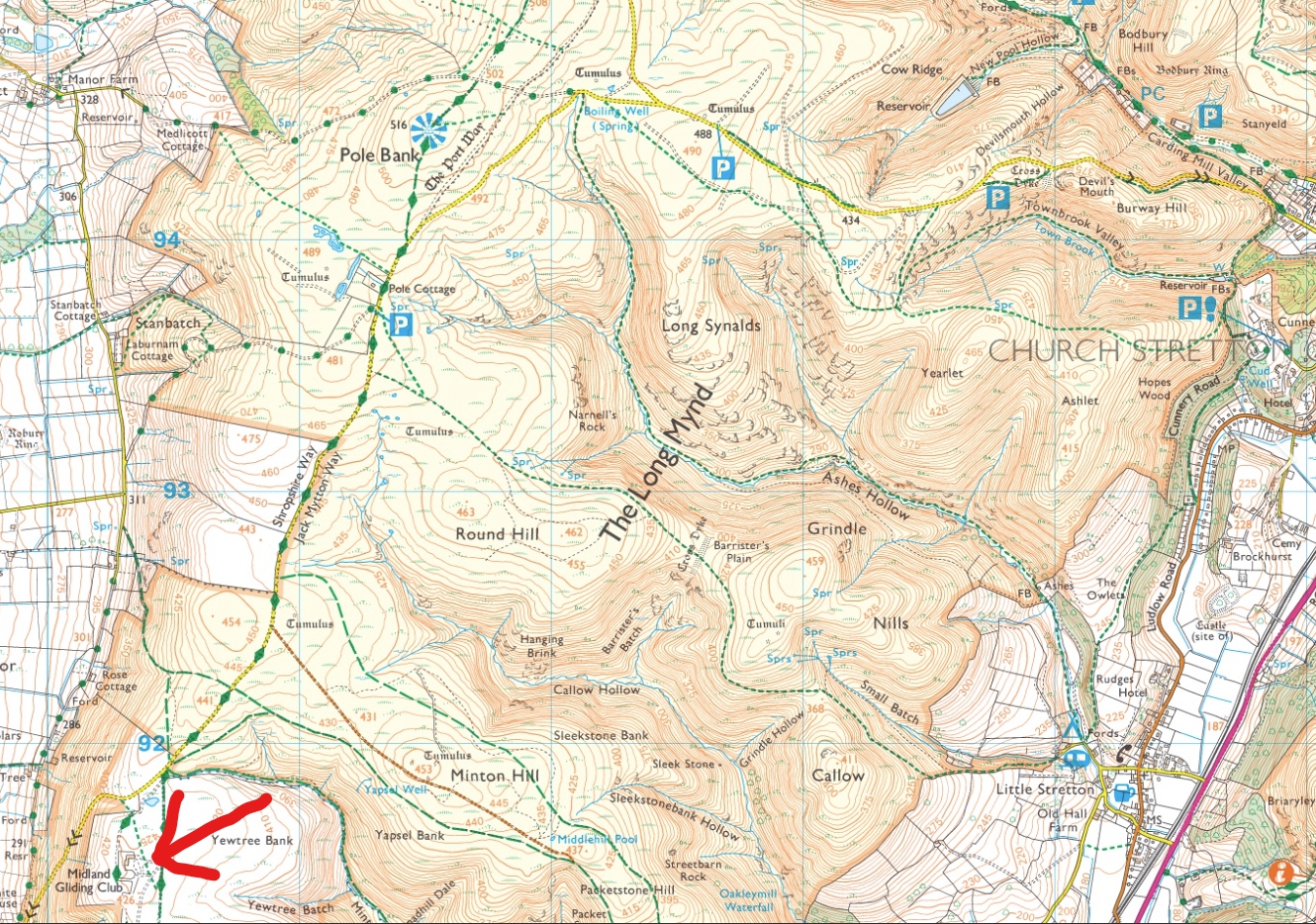
Grid Ref: SO403915
X: 340300m Y: 291500m
Lat: 52:31:07N (52.5186) Lon: 2:52:51W (-2.8808)
What Three Words: sheets.curly.slung
Airfield frequency 123.815
click here to see where we are within the region.
click here to see where we are on a local map.
click here to see location on OS map.
click here to see our location from the air (north of Shobdon airfield and south east of Welshpool airfield).
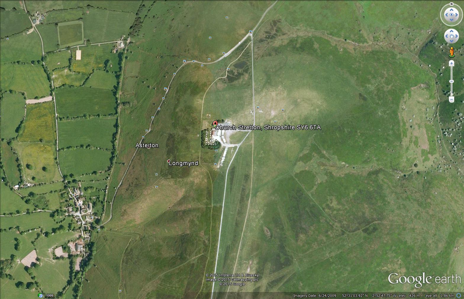
Driving up the Mynd
There are three roads up the Mynd to the Gliding Club. These are:
- from the east, via Church Stretton, up the Burway. Steep
- from the west, up Asterton. Short, but very steep.
- from the west, via Ratlinghope. Longer than the others, but not so steep.
All the roads, once you are on the Mynd, are narrow, and single track in places. If you have a good tow vehicle, all are possible (assuming good driving conditions!). Some are easier than others, though.
Route 1: Ratlinghope
This is the easiest route for a trailer, though it is also a little longer than the others. Click here for details. You can print these pages for reference when travelling.
Route 2: the Burway
This is via Church Stretton, just off the A49. If approaching from the south, turn left at the traffic lights on the A49, or right if coming from the north. Go over the railway bridge up the main road to the cross roads. Go straight over and follow the road for about two miles. This road is single track and very steep at the bottom but does have passing places. You will see a fork with a finger post. At the fork bear left to the gliding club, for a couple more miles. You will see it on the left.
Route 3: Asterton
This is the shortest, but also the steepest route, and you do need a pretty good tow vehicle to get up it. If coming from the south, it is faster than going via Church Stretton. You can see the route here, from the A49: Asterton route on google maps. The road up from Asterton is very steep and narrow but wide enough for a trailer.